


Satellite images released by Maxar Technologies shows residential homes and buildings in an area of Tonga in December (top picture) and the same area in January following the eruption of the Hunga-Tonga - Hunga-Haa'pai volcano. Photo: Satellite image ©2022 Maxar Technologies / AFP
Satellite images have revealed the scale of the devastation from the eruption of the Hunga Tonga Hunga Ha'apai volcano near Tonga. The photos show the near-total destruction of ash-covered island communities, with dozens of homes levelled to the ground. 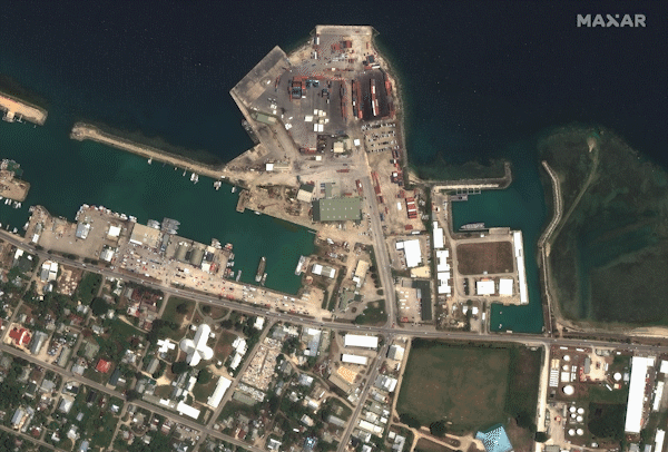 Saturday’s eruption, which could be seen from space, caused 15m-high tsunami waves that spread across the coast of Tonga’s main island, Tongatapu.
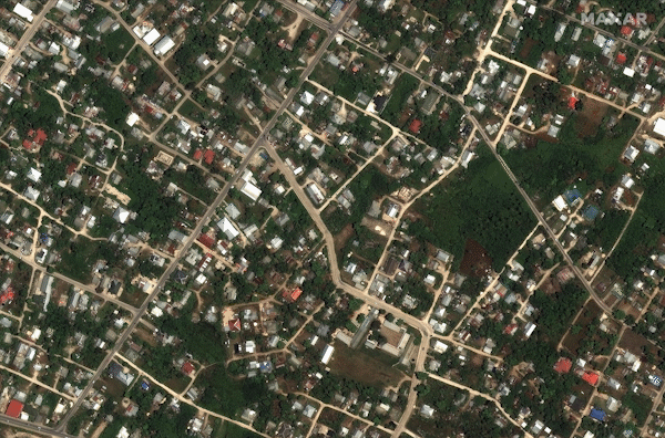 Earlier this morning, the Tongan government released its first official statement since the disaster, confirming that three people had died – two unnamed locals and British national Angela Glover – while “a number of injuries” had been reported.
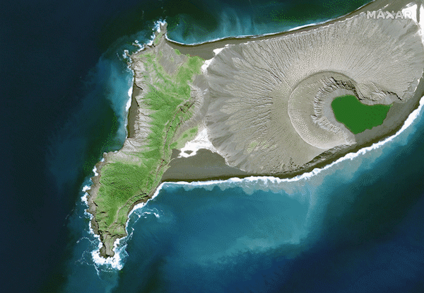 With the internet down and many phone lines severed, aid agencies and other countries have struggled to coordinate a response with local authorities, with Tonga’s government forced to rely on manual patrol boats to relay information. “Communications both international and domestic were severed due to damage sustained by the submarine cable from the eruptions and there was no further communication with the outer islands until the morning of Monday, 17 January after the deployment of His Majesty Armed Forces patrol boats,” the government said. “Due to the damage to the international fibre optics cable, internet is down. The two communications operators are working on satellite options to restore some services including the internet. Priority will be given to international calls and communication services such as emails.”
Advertisement
Every home on Mango island, where an estimated 50 people live, have been destroyed, while only two houses remain on Fonoifua island.
