
Credit: Jeff Schmaltz LANCE/EOSDIS MODIS Rapid Response Team, GSFC
Siberia is frozen much of the year, which is why Soviet geoengineers were once obsessed with trying to permanently melt it. But when the tundra thaws, it’s ripe territory for wildfires. This year’s been no exception: Just two weeks ago, around 16,463 hectares (nearly 47,000 acres) were ablaze in central Siberia.
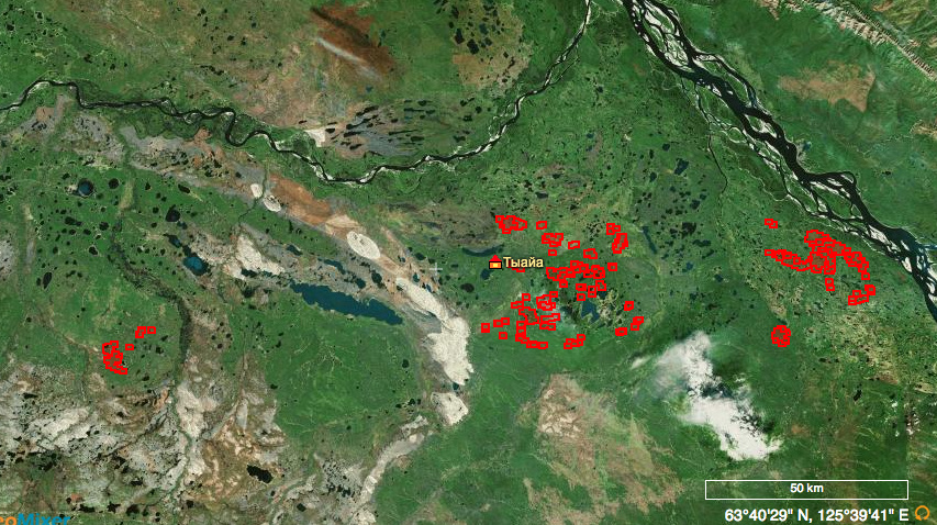
Things have calmed dramatically since then, but thousands of acres are still burning in the Sakha Republic. Thanks to NASA’s Moderate Resolution Imaging Spectroradiometer (MODIS), we can see the fires from space. The above photo was taken yesterday, with hot spots of active fires outlined in red.
Videos by VICE
According to a Russian mapping resource, there are a total of nine fires with 85 individual outbreaks in Suntarsky Ulus, the left region in the photo above, and eight fires and 237 outbreaks in Kobjajsky Ulus on the right. To get a sense of the size of the area, here’s a screenshot from the site, fires.kosmosnimki.ru:
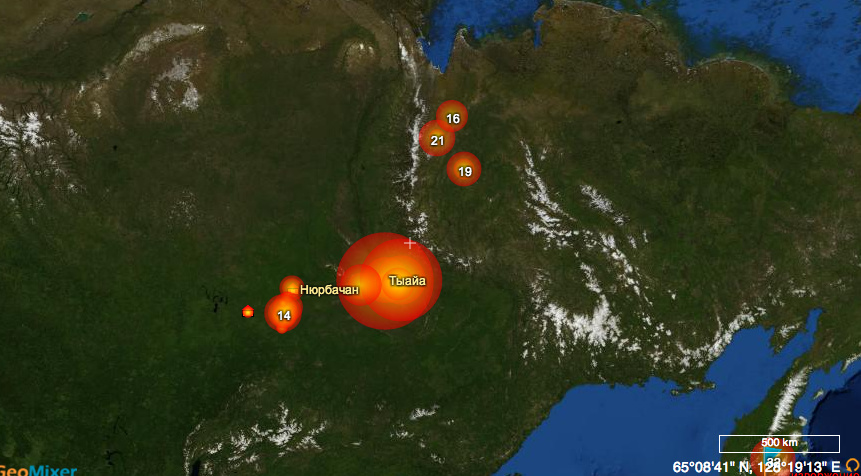
And then if we zoom out to Siberia at large, you can see this set of fires (central, large circles) is only one area that’s burning:
Russia Beyond the Headlines has been tracking the story, and on May 20th noted that fires had decreased six-fold in size. But just a day later, they’d grown again by 25 percent. Firefighting crews have successfully gotten a number of the fires under control, but as we can see from NASA’s latest image, there’s still a ways to go yet.
Of course, it’s incredibly remote terrain, and many of the fires will burn out on their own as they’re both hard to get to and not near anything but wild land. If you’re doubting just how barren Siberia can be, check out this MODIS image from May 10. Click to enlarge it, because it’s truly impressive stuff:
Credit: Jeff Schmaltz LANCE/EOSDIS MODIS Rapid Response Team, GSFC
More
From VICE
-

Daniel Garrido/Getty Images -

-

Steve Jennings/Getty Images -

Screenshot: The Pokémon Company